

New Mexico Rapid Assessment Method (NMRAM) Training Website
Welcome to the NMRAM Training Site!
• Learn about the NMRAM and how to efficiently evaluate ecological conditions of New Mexico’s wetlands and riparian areas.
• Get field guides and watch training videos to get started using NMRAM for your wetland projects, and sign up for field training sessions.
• Find out how to use the NMRAM to establish baselines to support conservation planning and restoration, particularly for CWA 319 projects.
The NMRAM is brought to you by the New Mexico Environment Department, Surface Water Quality Bureau, Wetlands Program’s and Natural Heritage New Mexico at the University of New Mexico to support on-going efforts to promote effective management and protection of the state’s wetland resources.
What is NMRAM?
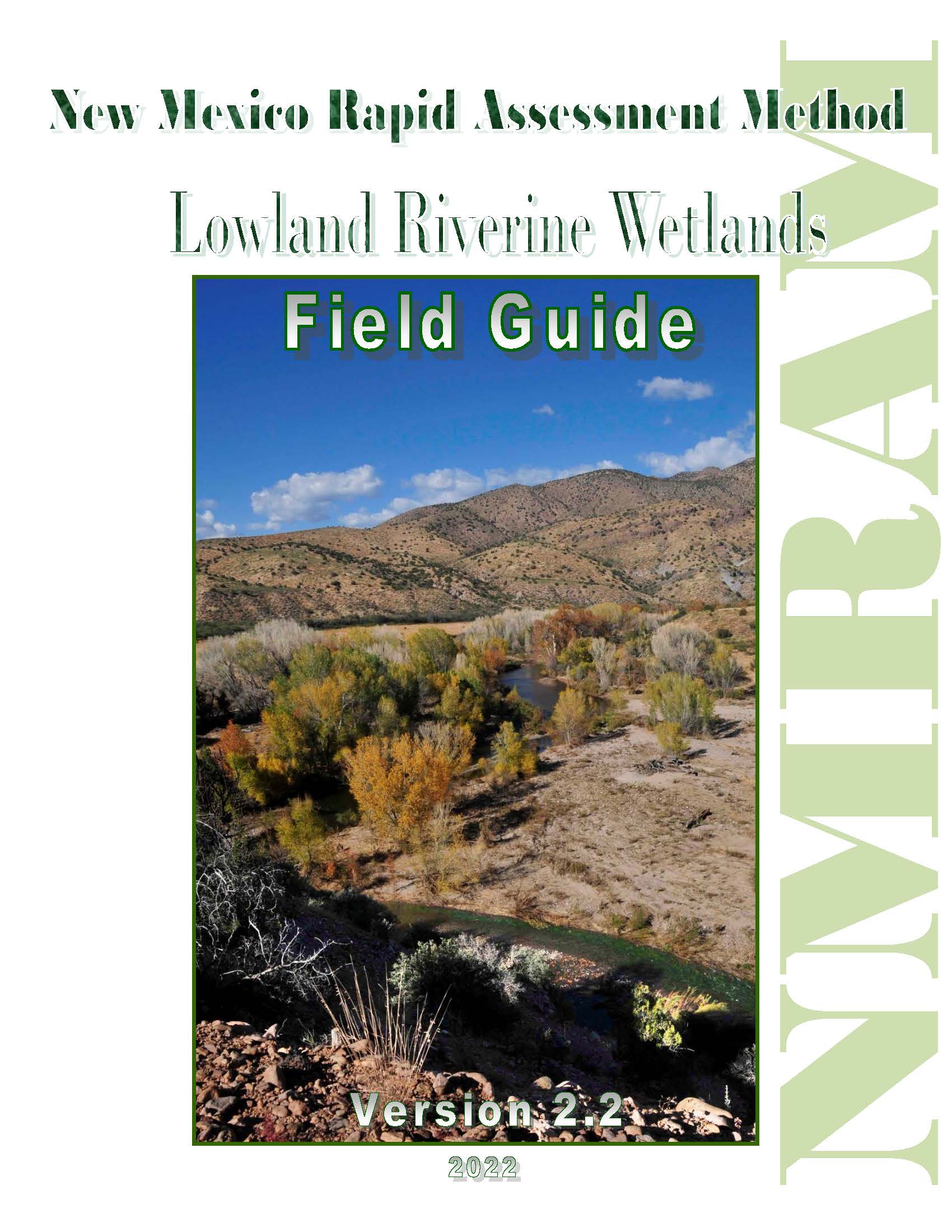
The NMRAM provides a cost-effective and consistent evidence-based tool for assessing wetland ecological condition for conservation planning and restoration. It uses a select set of observable and relatively easy-to-measure spatial analyses and field indicators (landscape, size, biotic and abiotic metrics) to express the relative condition of a particular wetland site in the context of a “reference set” of wetlands that vary along an anthropogenic-disturbance gradient. The ecological condition is evaluated and rated as excellent (A), good (B), fair (C), or poor (D) based on a preponderance of evidence provided by a set of semi-quantitative metrics that are sensitive to the gradient. The NMRAM Manual Version 2.0 provides details on the method and underlying rationale.
NMRAM Training
The NMRAM currently has four assessment modules corresponding to four major wetland types: Lowland Riverine, Montane Riverine, Confined Montane Valley, and Playa wetlands. For each module there are field guides and datasheets, with training videos also available for the Montane and Lowland Riverine modules. The field guides provide specific protocols for implementation along with field data sheets in digital and hard copy form. The data forms are in Adobe and are designed to be used with a digital pad in the field where the form calculates metric scores automatically. The forms can also be used manually. Access to a GIS or Google Earth is advisable for landscape-scale metrics.
Training videos are available on the training pages (Montane and Lowland) and provide step-by-step guidelines for measuring and rating each metric, and calculating the overall site ecological condition score. To the right are links to the training pages for both the Montane Riverine Wetlands and the Lowland Riverine Wetlands NMRAM. Each training page includes a series of short training videos, a set of downloadable presentations that go with the videos and a short course map listing the order in which the videos should be viewed. The appropriate field guide and datasheets should also be downloaded prior to starting the training.
NMRAM On-site Training. Periodically, we offer on-site training courses to supplement the on-line training along with a wetlands “Botany Booster” to support the evaluation of the biotic metrics.
The offerings will be posted here or you can request to be put on a mailing list to receive training updates.