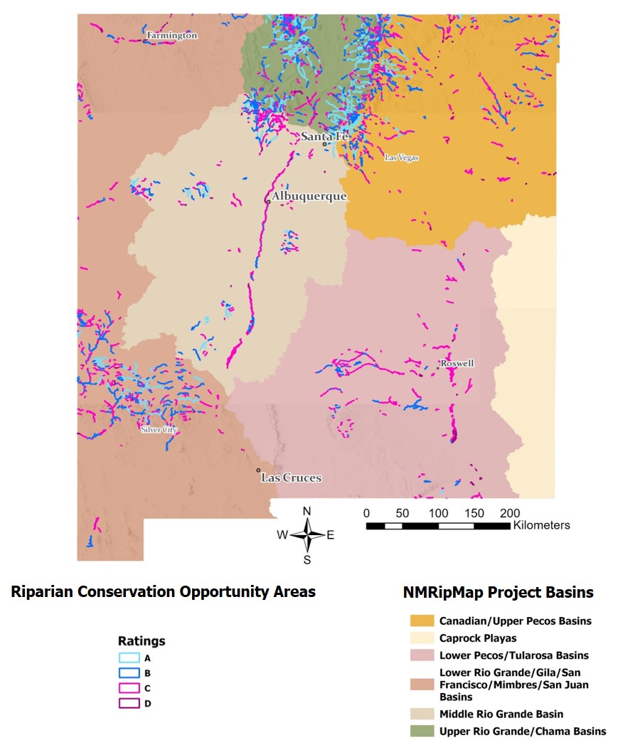
RCOA Version 2.0 Now Available!
 

Riparian Conservation Opportunity Areas (RCOAs) project

The RCOAs project stems from the Upper Rio Grande Ecological Assessment, a joint initiative by Natural Heritage New Mexico and the National Wildlife Federation.

The goal of this project is to maintain and enhance riparian connectivity in the Upper Rio Grande for wildlife populations, especially in the face of climate change.

To support this goal, we introduced the first version (Version 1.0) of the RCOA portfolio in 2022. Building on this foundation, we released an enhanced second version (Version 2.0) in June 2024. RCOAs are a combination of Riparian Strongholds and adjacent natural vegetated areas which can serve as potential restoration areas, or areas that provide additional types of riparian habitat for wildlife. These RCOAs can serve as place-based anchors to support conservation planning and actions (refer to User’s Guide for more details).


  • There are 700+ RCOAs in the Upper Rio Grande Basin. 

  • Each is rated from A down to D based on the amount of high-quality riparian vegetation and vegetation patch diversity. 


Explore the RCOA Map

Base Map: NMRipMap Version 2.0 Plus produced by NHNM. 


RCOA Products and Data