New Mexico Terrestrial Habitat Map (NMHabMap)
• NMHabMap is a comprehensive, fine-scale spatial view of the composition, cover, and structure of upland vegetation habitats of New Mexico’s mountains, plains, and deserts.
• NMHabMap is designed to serve wildlife habitat management, conservation and restoration planning, ecosystem assessment and monitoring design, and more.
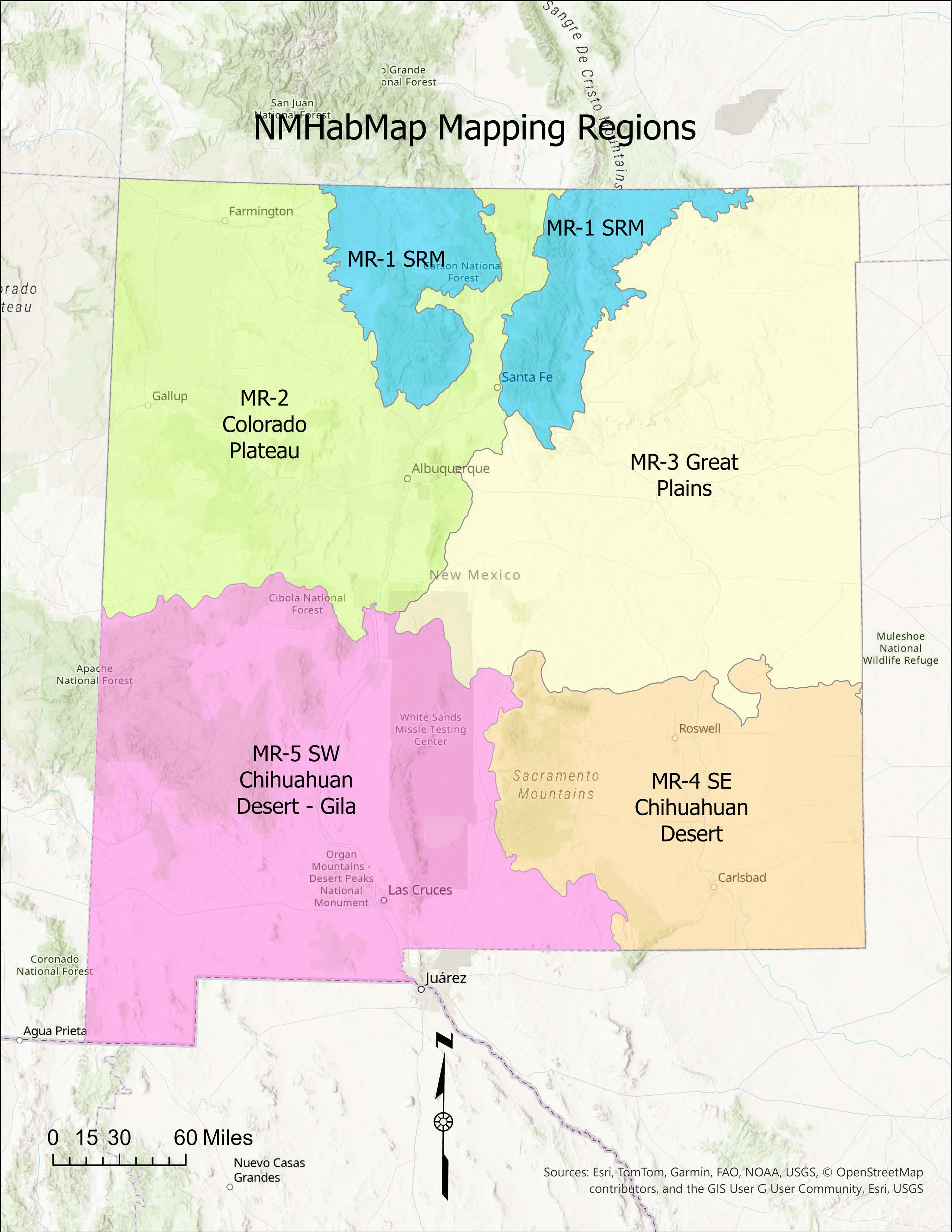
• NMHabMap is subdivided into five mapping regions that approximate the major ecoregions of the state and has a four-tiered legend of broad regional types down to detailed types found at local scales that follows the U.S. National Vegetation Classification.
Mapping Regions
Explore the Map

•This project was made possible by a grant from the New Mexico Department of Wildlife, XXXX Division
•Map produced by Natural Heritage New Mexico and Earth Data Analysis Center, University of New Mexico.